American Aerospace Technologies, Inc. (AATI), a data-driven infrastructure inspection company, recently completed a flight campaign in the San Joaquin Valley (SJV) of California with the AiRanger™ medium altitude long endurance UAS carrying its’ InstiMaps™ Automated Threat Detection System. AATI’s mission to conduct routine aerial patrol of critical infrastructure using advanced airborne sensors with integrated real-time Artificial Intelligence (AI) is transforming industry’s expectation of rapid data collection, analysis, and reporting.
During the three-week campaign, AATI conducted near real-time airborne threat detection and reporting patrols and validated operations of aircraft and the InstiMaps sensor system. With authorizations secured, and after several BVLOS missions over sparsely populated areas, AATI utilized the AiRanger™ to perform a dozen missions crossing the SJV, autonomously flying hundreds of square miles of infrastructure.
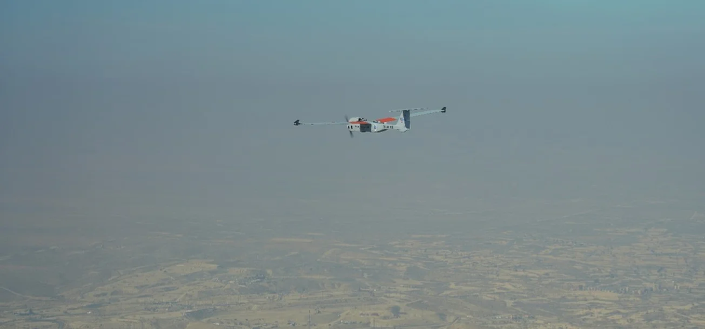
The AiRanger UAS is a fixed-wing unmanned aircraft capable of performing infrastructure inspection missions in a variety of configurations. AiRanger boasts an 18.2-foot wingspan and utilizes an extremely reliable propulsion system with 8.2-horsepower four-stroke engine offering smooth, quiet, and efficient power. With 220 pound max takeoff weight, the aircraft offers a large payload carrying capability (max 75 pounds, including up to 54 pounds of fuel), up to 900 watts of payload electrical power, 15,000’ ceiling and 15+ hour endurance.
AATI’s SJV mission was designed to validate infrastructure surveillance requirements, to address key factors that limit routine UAS operations and to provide outputs that will helpindustry partners compile the data to build a safety case that supports regulatory approval for routine commercial operations in the National Airspace System.
InstiMaps™ is an end-to-end system for manned and unmanned aircraft. InstiMaps acquires multispectral imagery and delivers high-resolution actionable data products to experts in the field and across the enterprise in near real-time. Using the latest technologies in the field of machine learning, the geo-located imagery is automatically analyzed, and threat imagery is delivered to damage prevention specialists for review and rapid response.

Image left: AATI’s AiRanger™ Unmanned Aircraft at take-off. Image right: Automating threat detection (with imagery) above a target pipeline during flight operations. November 2020
According to David Yoel, AATI CEO “America is increasingly managed by artificial intelligence (AI) and served by unmanned aircraft. The AiRanger™ BVLOS UAS operates at medium altitudes carrying advanced sensors and AI. We are transforming the way thatthe nation’s 500,000 miles of midstream pipelines are patrolled, providing a fundamentally new and unique capability that changes the way we manage health, safety and the environment, respond to disasters, optimize operations and leverage human capital.”
More information at www.americanaerospace.com